


Trade area and catchment mapping
Draw a drive-time catchment, plot customer density and identify gaps for the next location or marketing push.
Draw store catchments, plot competitors, map delivery radius and assign franchise territories, built for single-location stores, franchisees and small chains.
 4.7 / 5 · 200 reviews on G2

★ ★ ★ ★ ★“Fantastic tool for market and sales analysis. Offers a visual layout of customer and competitor locations in a given geographical region.”
Draw catchments, drive-time zones and competitor radius rings on real satellite imagery. No GIS analyst required.
Send a clean trade-area map to franchisees, marketing or operations. They open it in a browser. No install, no account.
Map a CSV of customers, store locations or transaction data. Every row geocodes onto the map automatically.
Draw a drive-time catchment, plot customer density and identify gaps for the next location or marketing push.
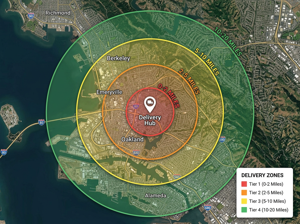
Draw your delivery radius, color tiers by mileage and share with customers and the operations team.
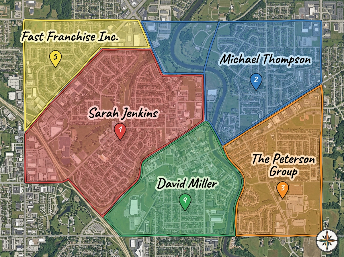
Color-code each franchisee's territory so corporate, marketing and franchisees see exactly who owns which area.
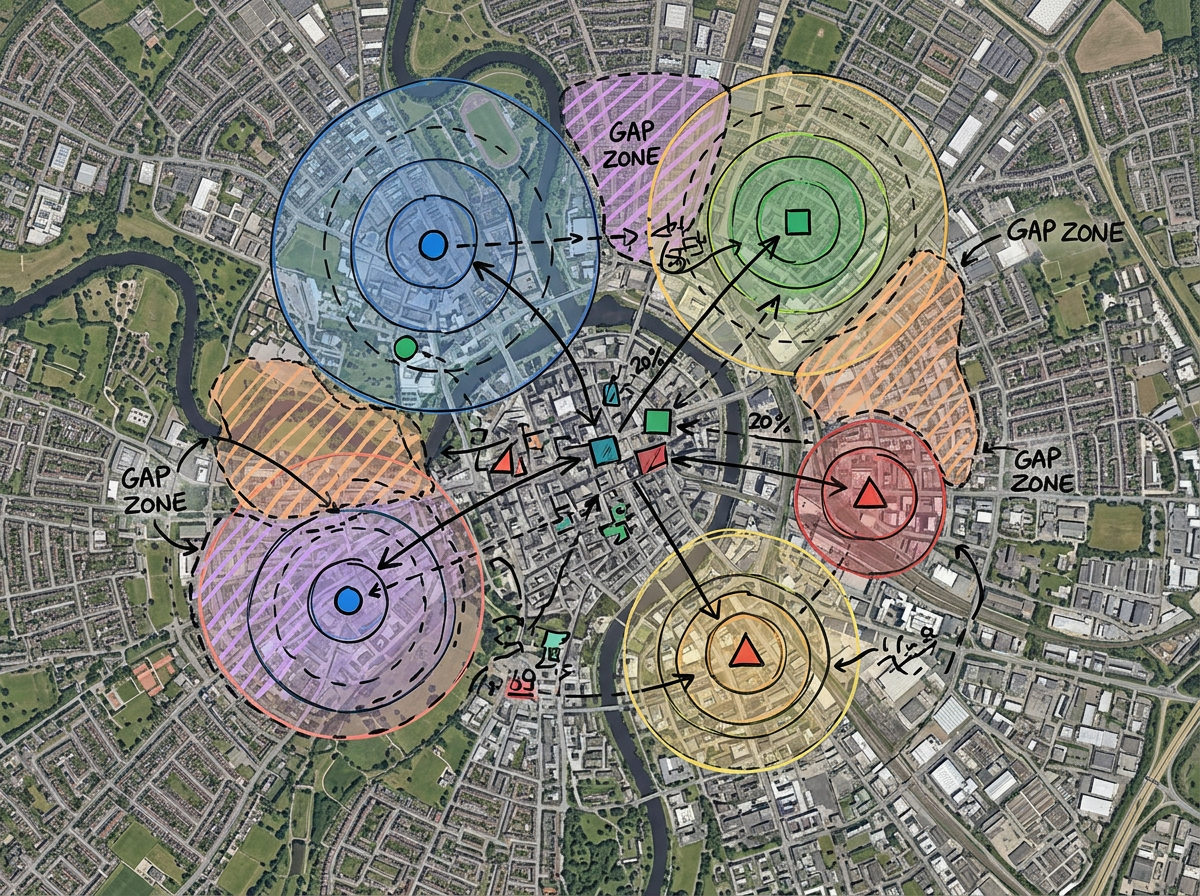
Plot competitor locations, mark deposit-share rings and identify market gaps for the next store, kiosk or pop-up.
Scribble Sight
Find the best locations for retail using Places, foot-traffic, Walkscore™, demographics, air quality, pollen and more. Compare candidates side by side and turn instinct into a data-backed decision.
Try Scribble Sight →Scribble AI
Tell Scribble AI what you need. Try “draw a 500m buffer around every site,” “import this CSV and color by status,” or “measure the route from the depot to each stop.” It does it in seconds. No GIS training needed, and your team gets the same map, ready to share.
Try Scribble AI →★ ★ ★ ★ ★“Fantastic tool for market and sales analysis. Offers a visual layout of customer and competitor locations in a given geographical region.”
★ ★ ★ ★ ★“I love how easy it is to make the maps to generate a space for where our customers are primarily located. I can then share this with the team.”
Yes. Scribble Maps supports travel-time isochrones. Drop a store, pick a drive time and the area is drawn automatically.
Yes. Paste from a spreadsheet or import a CSV. Every address geocodes onto the map in one pass.
Yes. Generate an embed code and paste it into your site. Customers can check delivery range without leaving the page.
Yes. Click Share, copy the link and email it to each franchisee. They open it in any browser. No install.