

Public meeting and council briefings
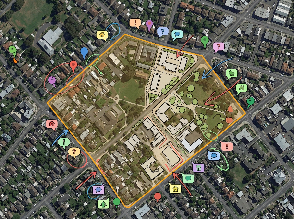
Annotate a proposed project area, mark stakeholder concerns and project a clean map onto the council chamber screen.
Public works, planning, parks, council briefings and citizen engagement on shared maps any staff member can build and any resident can open.
 4.7 / 5 · 200 reviews on G2
★ ★ ★ ★ ★“I use scribble maps to plot all of the apartment communities our company has over 18 states. This visual helps when I make presentations to the owner of the company and helps demonstrate the balance of properties.”
Zoning, public works, parks, transit, emergency management. Every team can build the maps they need without waiting on GIS.
Share a clean, branded map with the council, post it to a public meeting page or embed it in a project site. Residents open it in any browser.
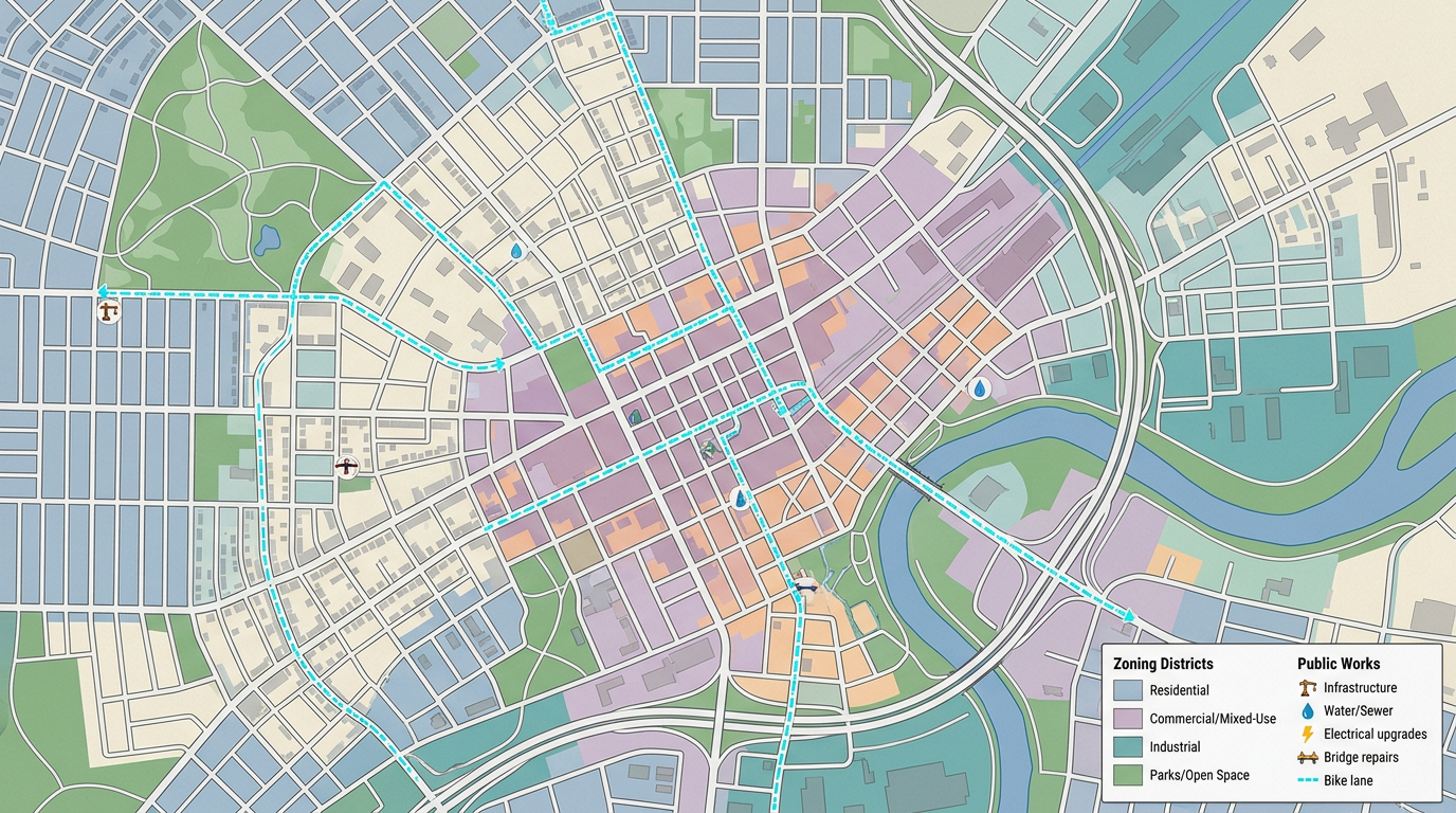
Import existing KML, Shapefile, GeoJSON or CSV data. Overlay parcels, infrastructure or census layers without re-keying.
Annotate a proposed project area, mark stakeholder concerns and project a clean map onto the council chamber screen.
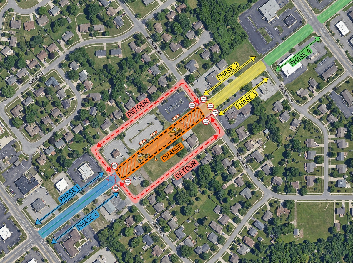
Map paving schedules, sidewalk repairs, signal replacements and utility cuts on a single shared map for the project team.
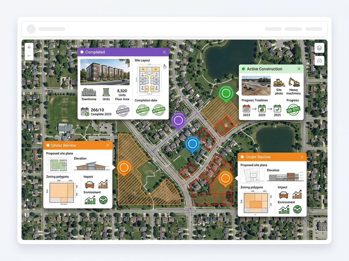
Embed an interactive project map on a public website so residents can pan, zoom and read project notes themselves.
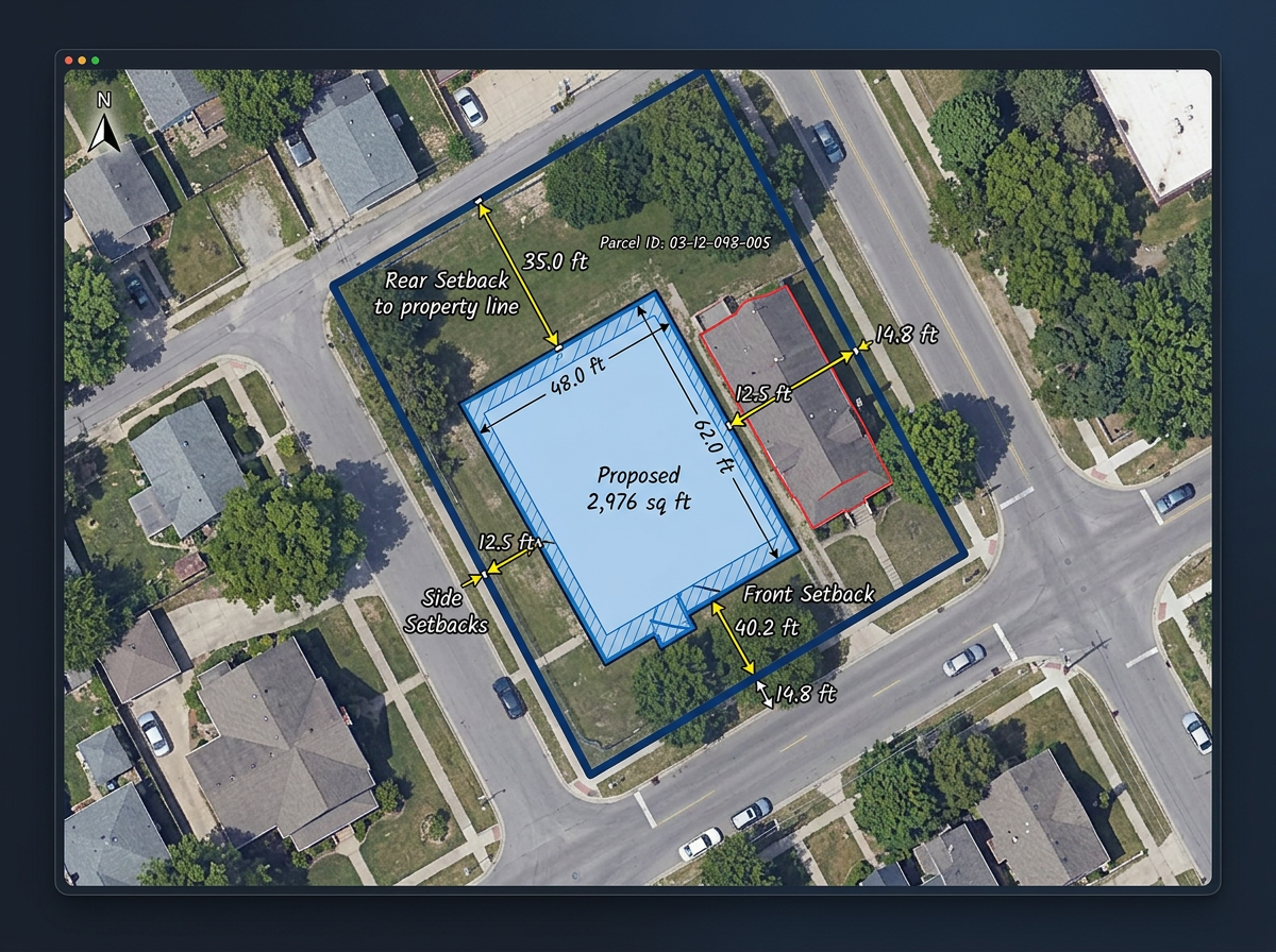
Walk a planning commission through a parcel, draw the proposed footprint and show setbacks, view corridors and adjacent uses.
Scribble AI
Tell Scribble AI what you need. Try “draw a 500m buffer around every site,” “import this CSV and color by status,” or “measure the route from the depot to each stop.” It does it in seconds. No GIS training needed, and your team gets the same map, ready to share.
Try Scribble AI →★ ★ ★ ★ ★“I use scribble maps to plot all of the apartment communities our company has over 18 states. This visual helps when I make presentations to the owner of the company.”
★ ★ ★ ★ ★“What I appreciate most about Scribble Maps is its intuitive interface and versatility. It enables me to easily draw, label, and personalize maps without needing advanced GIS expertise.”
No. Scribble Maps works in any modern browser. Departments can be productive on day one without an ArcGIS deployment.
Yes. Anyone with the link can view a shared map in their browser. No account, no install, no friction.
Yes. Scribble Maps supports SAML/OIDC/SCIM, activity and audit logs, and user management.
Yes. Generate an embed code from any map and paste it into your CMS. Updates to the map appear automatically on the site.