

Visitor maps and trail guides
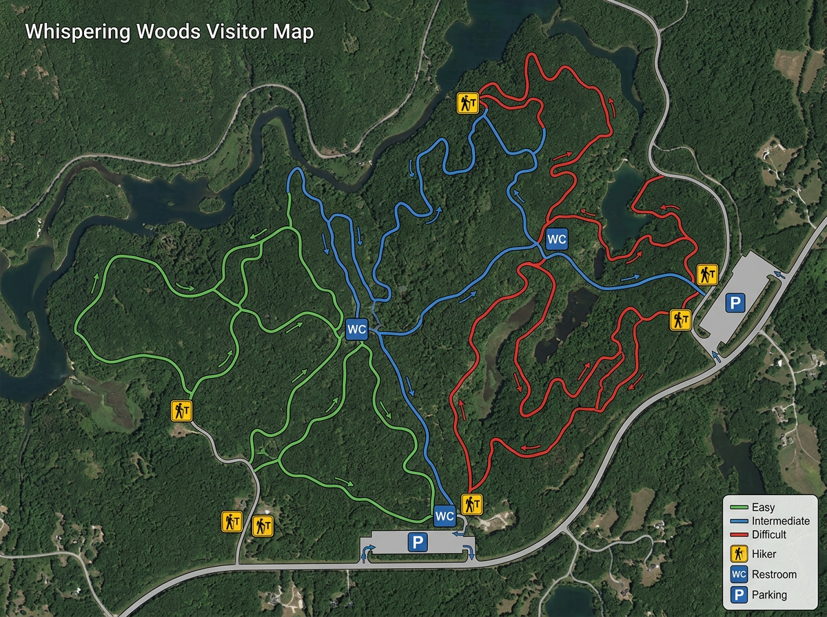
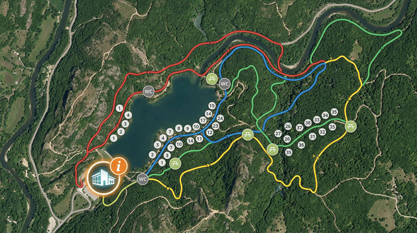
Publish a clickable visitor map with trails, campsites, restrooms, trailheads and parking. Share it on your park website.
Build visitor maps, trail guides and maintenance plans for your park district, trail association or friends-of-the-park group. Free, fast and shareable.
 4.7 / 5 · 200 reviews on G2
★ ★ ★ ★ ★“I like that we can highlight and fill in certain areas and mark features within a community such as a park, playground or pool. We use Scribble Maps nearly daily. It is easy to use and implement within our team.”
Draw trails, mark campsites, restrooms, picnic areas and play structures on satellite imagery. No CAD program required.
Share a visitor map by link or embed it on your park website. Guests open it in a browser. No app download, no friction.
Import GPX or KML tracks from rangers, contractors or volunteers. Layer them on one shared park map.
Publish a clickable visitor map with trails, campsites, restrooms, trailheads and parking. Share it on your park website.
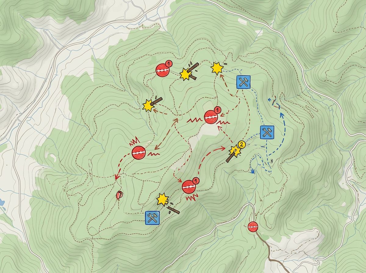
Mark wash-outs, blowdowns and maintenance priorities on the map. Share with crews and volunteers by link.
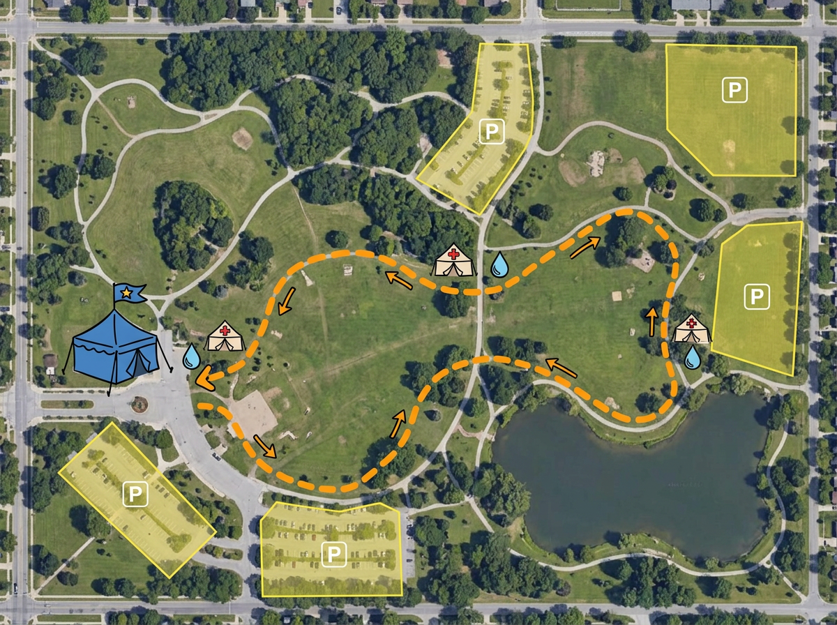
Map race courses, registration tents, aid stations and parking for park events. Share with staff, volunteers and participants.
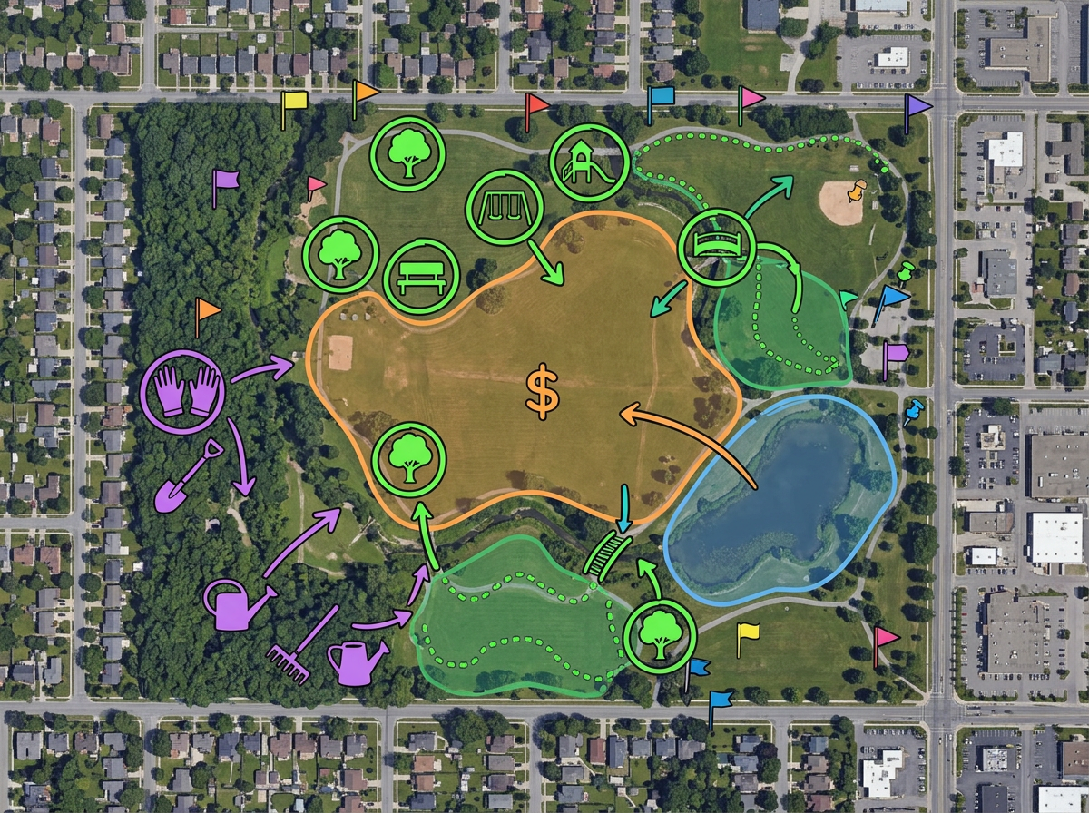
Map proposed improvements, volunteer work days or fundraising priorities for your friends-of-the-park group.
Scribble AI
Tell Scribble AI what you need. Try “draw a 500m buffer around every site,” “import this CSV and color by status,” or “measure the route from the depot to each stop.” It does it in seconds. No GIS training needed, and your team gets the same map, ready to share.
Try Scribble AI →★ ★ ★ ★ ★“I like that we can highlight and fill in certain areas and mark features within a community such as a park, playground or pool.”
★ ★ ★ ★ ★“Back in the day with paper maps, I always enjoyed marking places I'd explored on bike or on foot with a highlighter pen. I now have maps with whatever background I fancy overlaid with all my explorations.”
Yes. Generate an embed code and paste it into your site. Visitors can pan, zoom and toggle layers without leaving the page.
Yes. Import GPX, KML, Shapefile or GeoJSON. Tracks and waypoints drop directly onto the map.
Yes. Anyone with the link can open the map in a mobile browser. No app, no account, no friction.
Yes. Export any map to PDF or PNG at any zoom level for printed guides, kiosk displays or park brochures.