

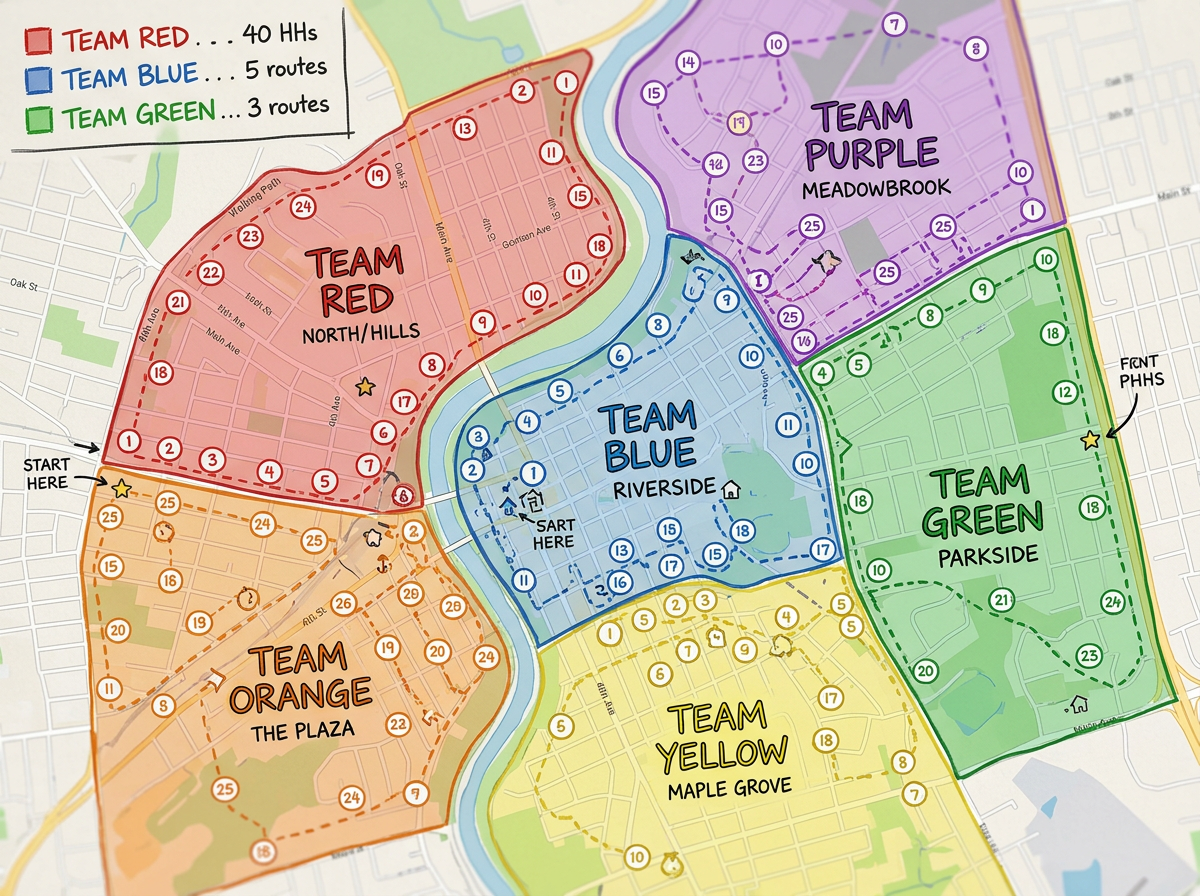
Outreach and canvassing routes
Assign neighborhoods to outreach teams, draw routes and share a clickable map with each volunteer group.
Map outreach routes, small group locations, parish boundaries and mission footprints. Free, fast and shareable. No install, no account to view.
 4.7 / 5 · 200 reviews on G2
★ ★ ★ ★ ★“Scribble Maps addresses our route-setting challenges. By selecting the course and location, their roles and areas are delineated to avoid overlap, resulting in a more efficient and effective operation.”
Draw parish boundaries, outreach zones and neighborhood territories on a satellite view. No GIS training required.
Share a clickable map with volunteers, small group leaders or mission teams. They open it in a browser. No install, no account.
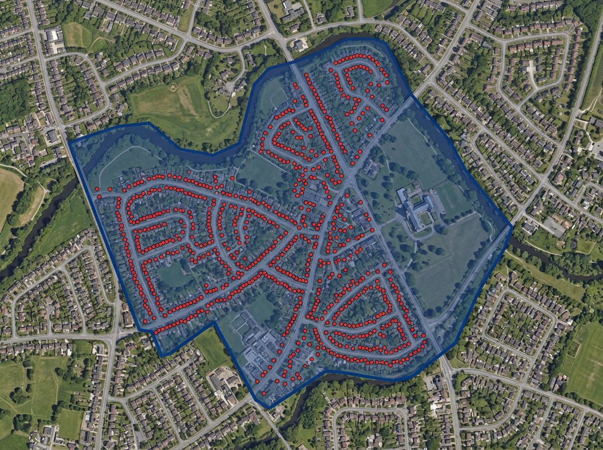
Map a CSV of members, small groups or prayer requests. Every address geocodes onto the map automatically.
Assign neighborhoods to outreach teams, draw routes and share a clickable map with each volunteer group.
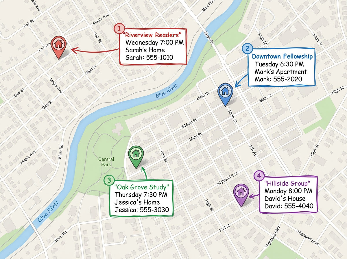
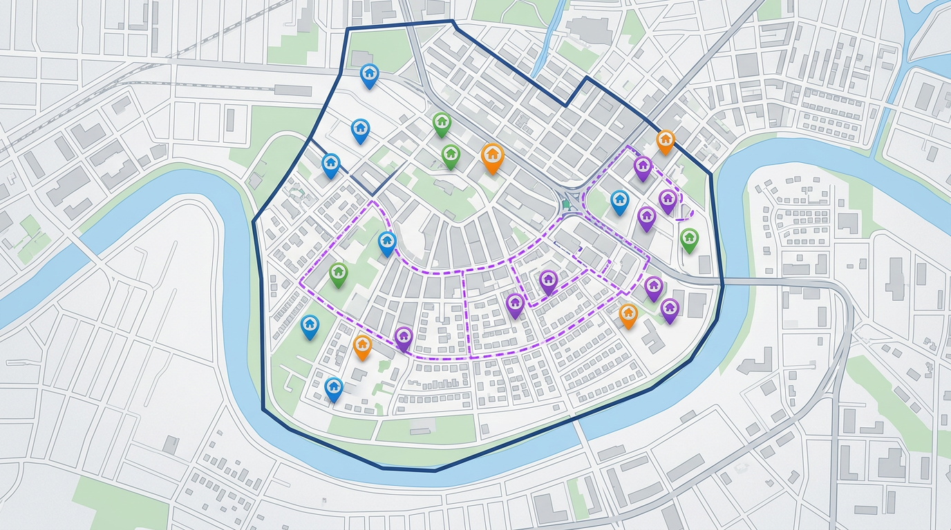
Plot every small group or home meeting on the map. Share with members so they can find the group closest to them.
Map your parish or congregation boundary and share with members, clergy and partner organizations.
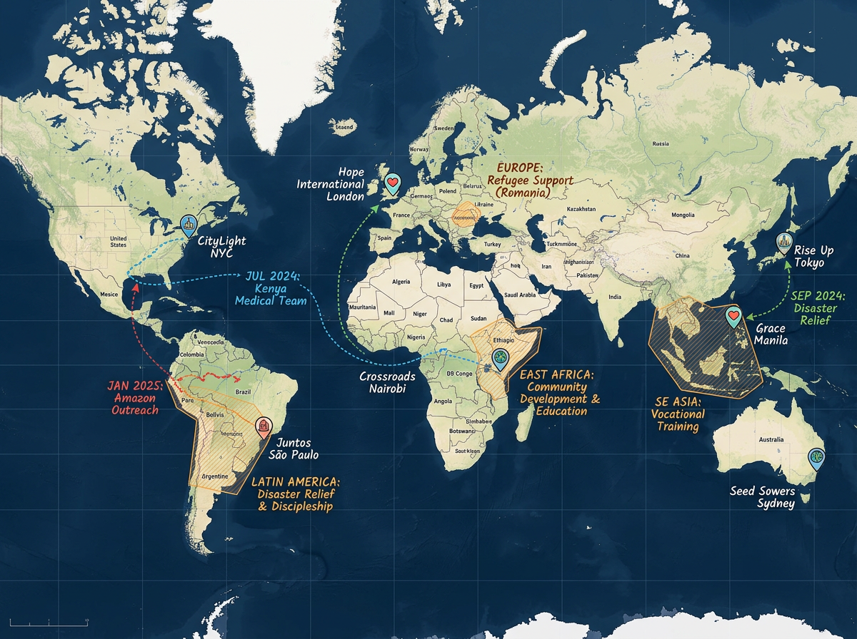
Build a global or regional mission map showing partner ministries, supported projects and travel routes.
Scribble AI
Tell Scribble AI what you need. Try “draw a 500m buffer around every site,” “import this CSV and color by status,” or “measure the route from the depot to each stop.” It does it in seconds. No GIS training needed, and your team gets the same map, ready to share.
Try Scribble AI →★ ★ ★ ★“Scribble Maps addresses our route-setting challenges. By selecting the course and location, their roles and areas are delineated to avoid overlap.”
★ ★ ★ ★ ★“Scribble Maps customer service is like having Alexa, Siri and an easy button at your desk at all times. Such a small town feel!”
Yes. Scribble Maps is free for individual users and small teams. See the pricing page for larger imports, private maps and advanced tools.
Yes. Paste from a spreadsheet or import a CSV. Every address geocodes onto the map in one pass.
Yes. Scribble Maps supports private maps, password protection and AES-256 encryption.
Yes. Generate an embed code and paste it into your church website. Members open it without leaving the page.