

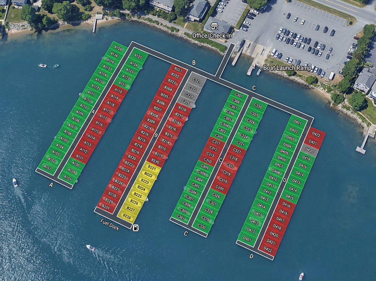
Marina layouts and slip plans
Number every slip on the satellite view, color by occupancy or boat class, and share with dock staff and incoming captains.
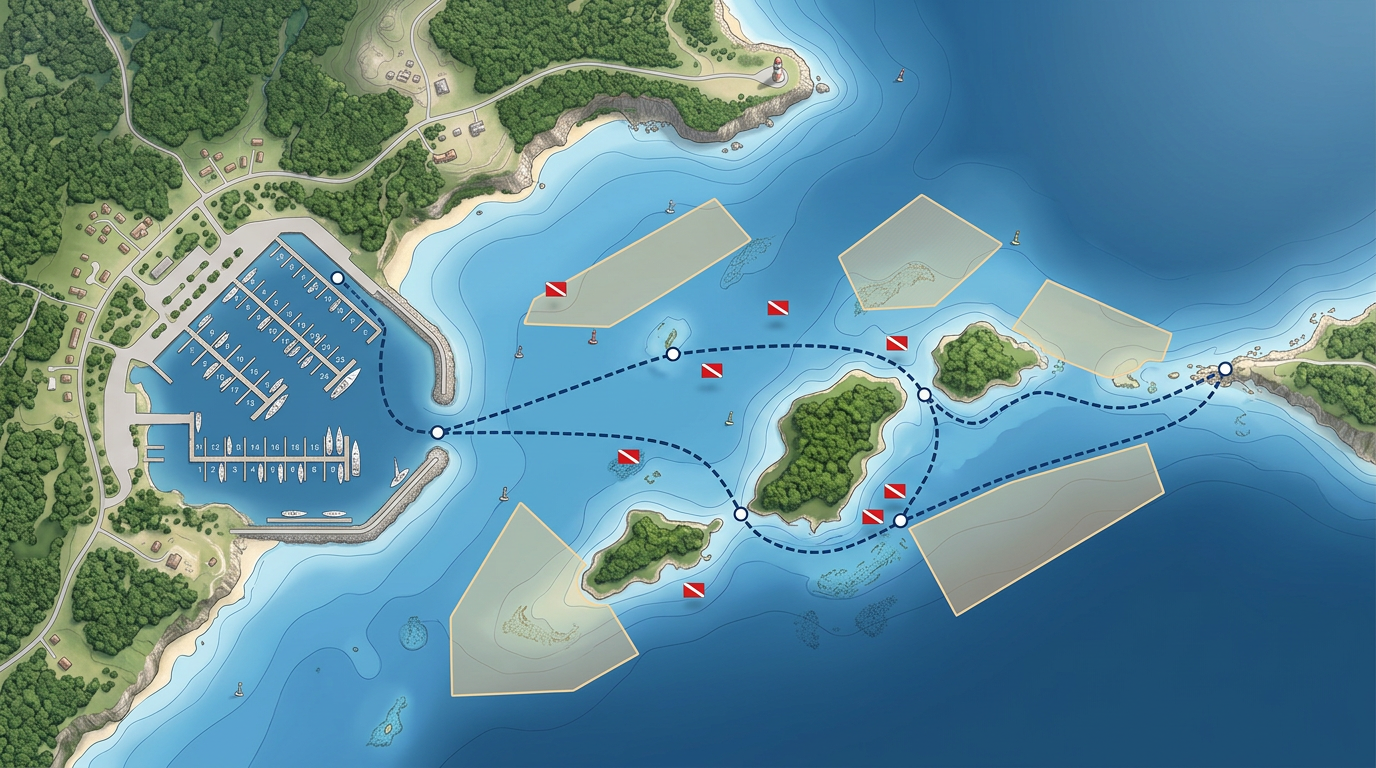
Marina layouts, dive sites, fishing zones and charter routes, drawn fast and shared by link with crews, customers and partners.
 4.7 / 5 · 200 reviews on G2
★ ★ ★ ★“I use it to map underwater SCUBA diving sites. It is very simple to use and saves time while making a graphically appealing map for customers.”
Drop moorings, dive sites and waypoints on real satellite imagery. Measure distances and bearings without a CAD program.
Share a route or site map with the captain by link. They open it on a phone or tablet. No app required.
Import GPX waypoint and track files from a chartplotter, layer them and export back out for any device.
Number every slip on the satellite view, color by occupancy or boat class, and share with dock staff and incoming captains.
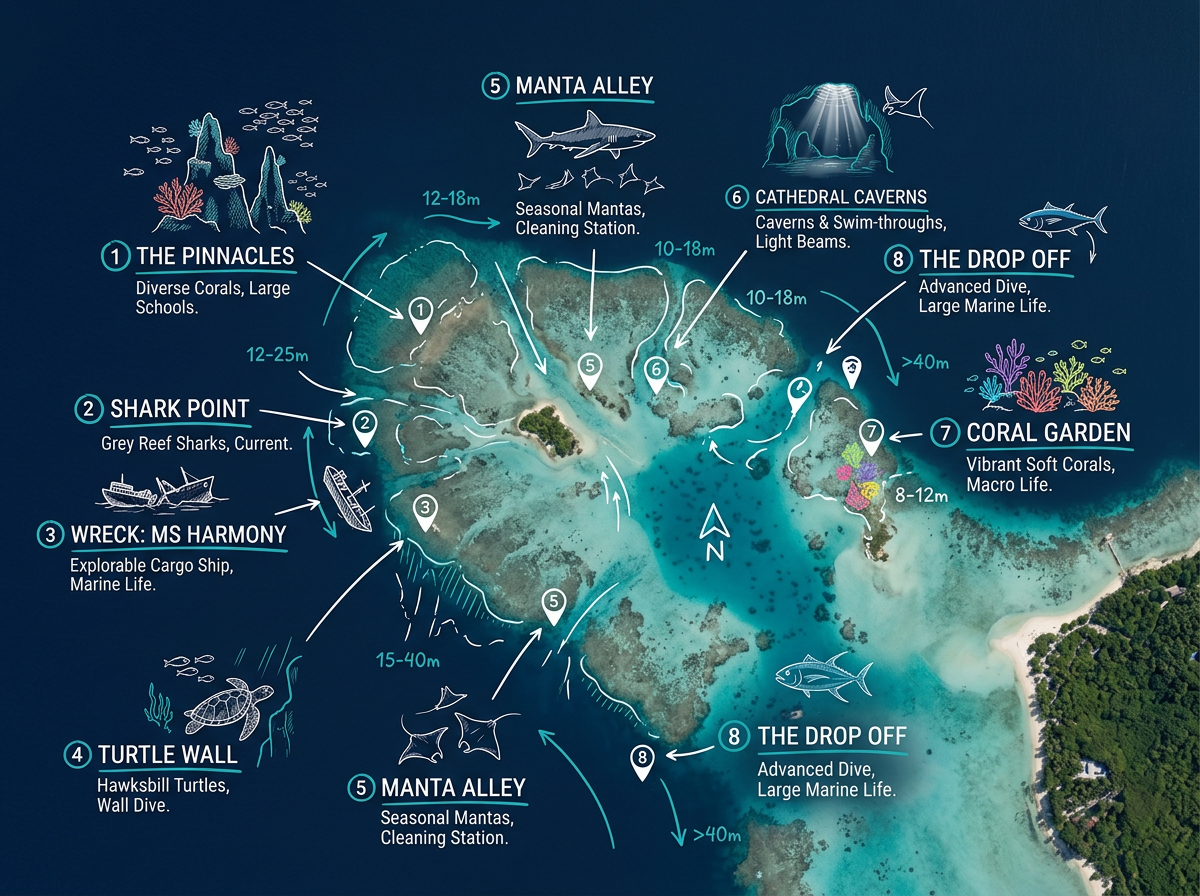
Plot every dive site with depth, hazard and feature notes. Share with customers as a clickable site catalog.
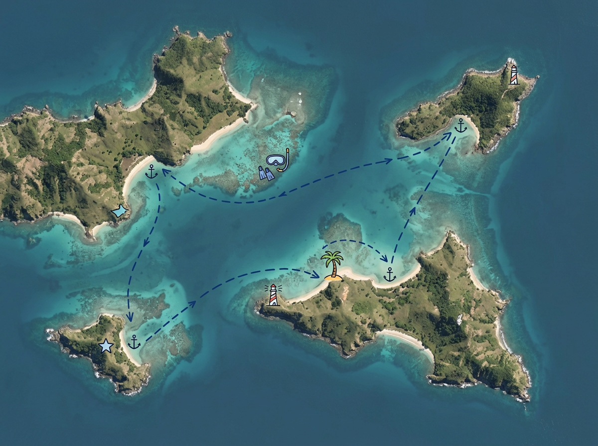
Draw a charter or sailing route with stops, anchorages and points of interest. Share with guests before departure.
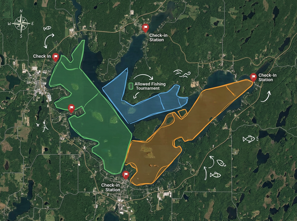
Map allowed zones, tournament boundaries and check-in points so every angler knows where they can fish.
Scribble AI
Tell Scribble AI what you need. Try “draw a 500m buffer around every site,” “import this CSV and color by status,” or “measure the route from the depot to each stop.” It does it in seconds. No GIS training needed, and your team gets the same map, ready to share.
Try Scribble AI →★ ★ ★ ★“I use it to map underwater SCUBA diving sites. It is very simple to use and saves time while making a graphically appealing map for customers.”
★ ★ ★ ★“I appreciate Scribble Maps easy to use interface and flexibility, especially when it comes to graphics. The program has also been easy to integrate and implement and their customer service has been EXTREMELY responsive to my inquiries.”
Scribble Maps uses satellite, street, terrain and hybrid base maps. For coastal and marina work, many users find satellite imagery enough. You can overlay official chart imagery as an image layer if needed.
Yes. Import GPX, KML, Shapefile or GeoJSON. Tracks and waypoints drop directly onto the map.
Yes. Export any route as GPX or KML for use on most chartplotters and navigation apps.
Yes. Anyone with a sharing link can open it in any mobile browser. No app, no account.