

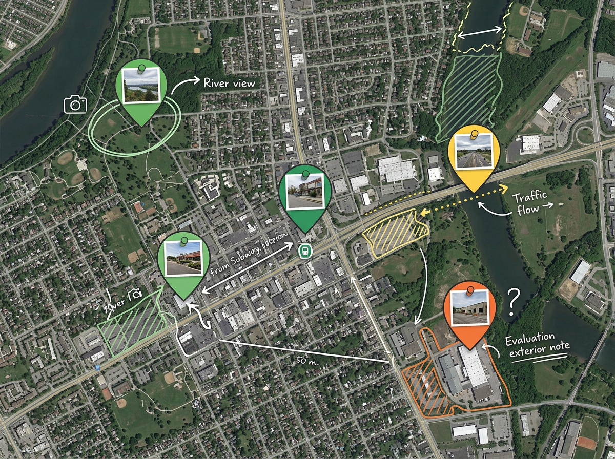
Location scouting
Plot every candidate spot a scout finds, attach photos and notes, score by sun direction, access and noise, then walk producers through the top three on one shareable map.
Drop pins on candidate locations, draw the unit move, mark base camp, parking and the closure perimeter, then share a link the whole crew can open.
 4.7 / 5 · 200 reviews on G2
Drop pins on every candidate location, attach reference photos and shot notes, and mark the angles you want, all without opening a GIS tool.
Share a private link with the producer, AD, locations and the rest of the crew. They open it on a phone in any browser. No app, no account.
Import a CSV of candidate locations, KML from a scouting trip or a GeoJSON of permitted zones. Style every pin by status, day or unit.
Plot every candidate spot a scout finds, attach photos and notes, score by sun direction, access and noise, then walk producers through the top three on one shareable map.
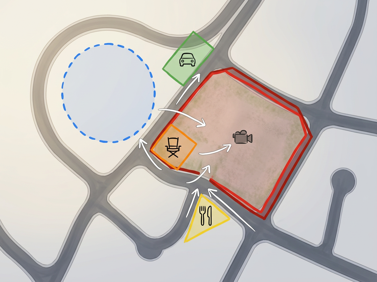
Mark base camp, crew parking, holding, catering, the closure perimeter and camera positions on a single map every department can pull up on set.
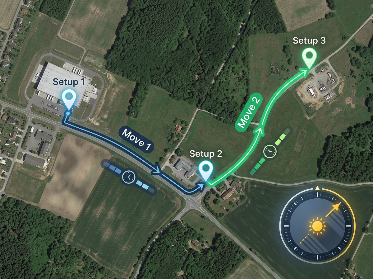
Draw the route from base camp to each setup, measure travel time and walk distance, and plan the day so the gaffer doesn't lose the light.
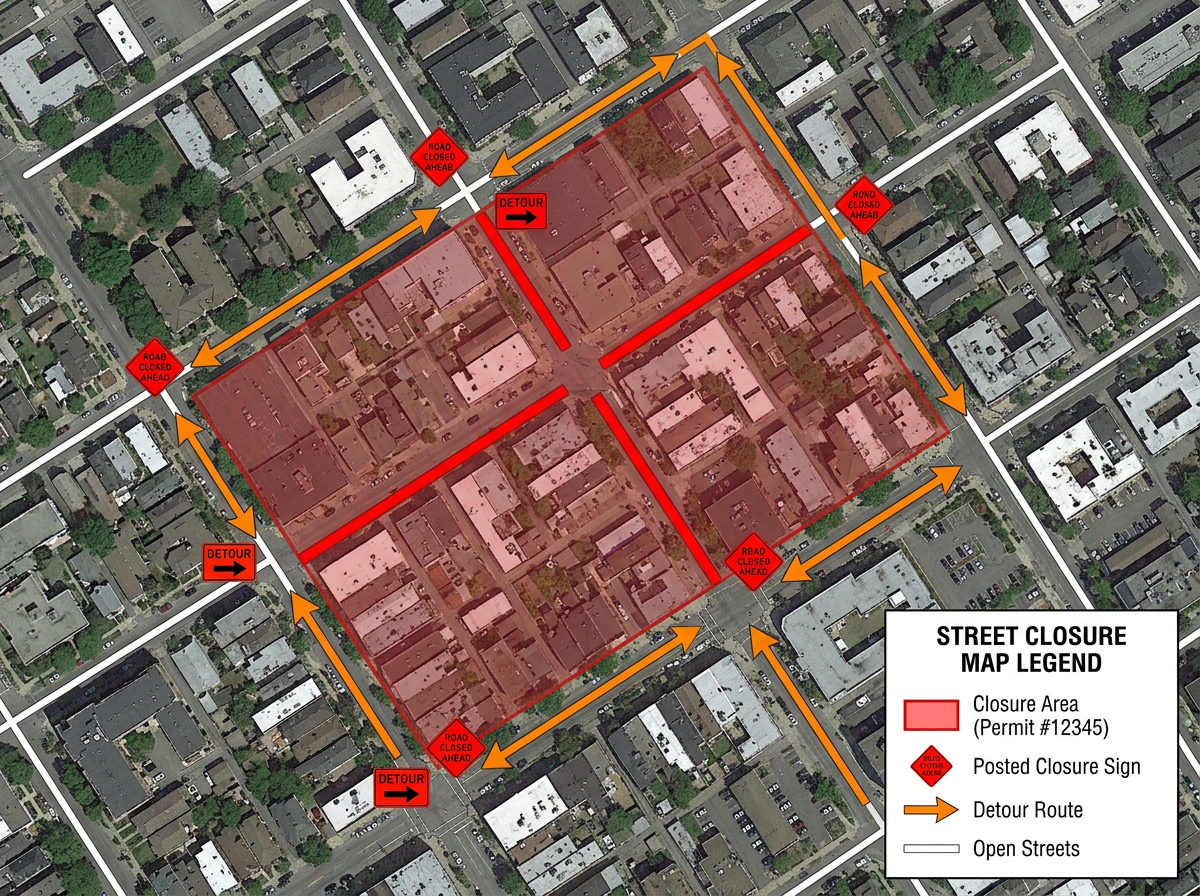
Outline the closure footprint, mark posted signage and detour routes, and hand a clean PDF to the city for the permit application.
Scribble Sight
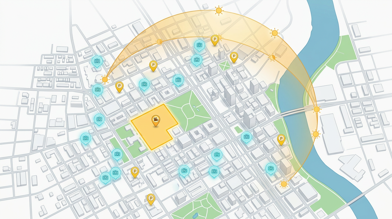
Find the best locations for film production using Places, foot-traffic, Walkscore™, demographics, air quality, pollen and more. Compare candidates side by side and turn instinct into a data-backed decision.
Try Scribble Sight →Scribble AI
Tell Scribble AI what you need. Try “draw a 500m buffer around every site,” “import this CSV and color by status,” or “measure the route from the depot to each stop.” It does it in seconds. No GIS training needed, and your team gets the same map, ready to share.
Try Scribble AI →It complements one. Keep your library wherever it lives today and use Scribble Maps to share, plan and brief on the locations you've already shortlisted.
Yes. Share a link, set view-only or edit permissions, and revoke at any time. The recipient opens it in any browser. No install, no signup.
Yes. Import CSV, KML, GeoJSON, GPX or Shapefile, then style markers by any column like status, day, unit or department.
Free to start. Paid options add private maps, larger uploads and admin controls. See the pricing page for details.