

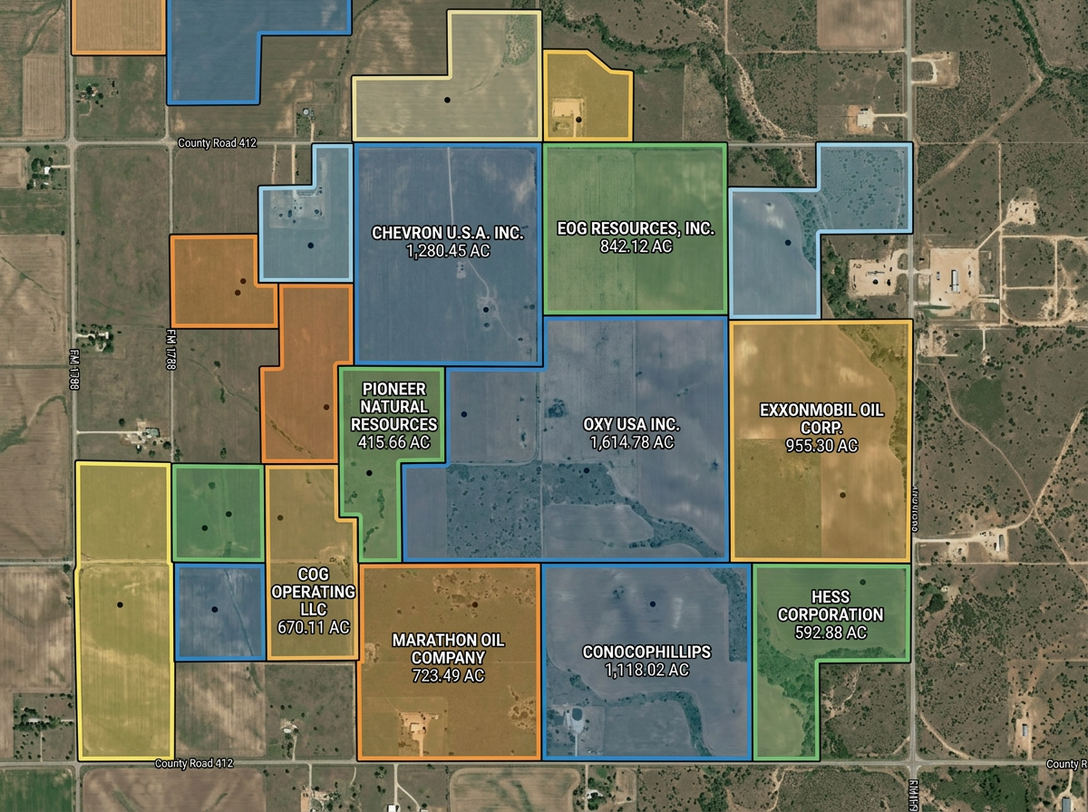
Lease and parcel maps
Draw lease blocks, parcel boundaries and ownership outlines for landmen, attorneys and operators.
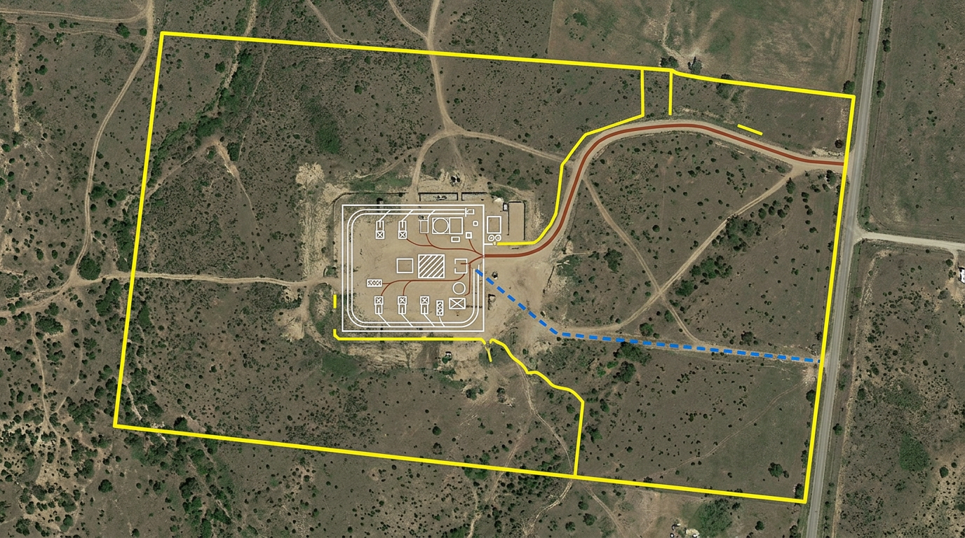
Quick lease and parcel maps, pad layouts, gathering-line sketches and environmental exhibits, built for service companies, landmen, environmental consultants and field crews.
 4.7 / 5 · 200 reviews on G2
★ ★ ★ ★ ★“What I appreciate most about Scribble Maps is its intuitive interface and versatility. It enables me to easily draw, label, and personalize maps without needing advanced GIS expertise. Being able to view distances between points and share this information with workers has made it an invaluable tool for planning and communicating on my job sites.”
Draw lease boundaries, pad layouts, gathering lines and access roads on satellite imagery. No CAD program required.
Share the lease or pad map with the field crew, contractor or landowner. They open it on a phone. No install.
Import KML, Shapefile, GeoJSON or CSV of leases, parcels and existing infrastructure. Layer it all on one shared map.
Draw lease blocks, parcel boundaries and ownership outlines for landmen, attorneys and operators.
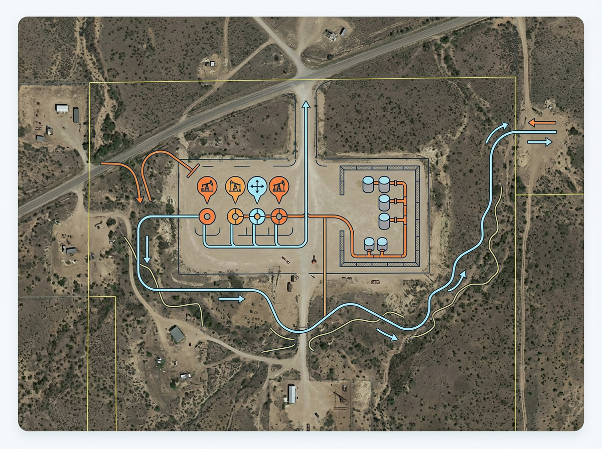
Sketch a pad layout on a candidate site, mark wellheads, tank batteries and gathering line routes for the build crew.
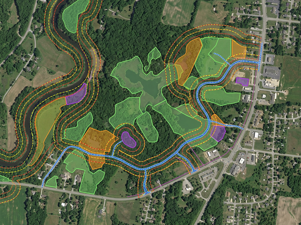
Build environmental and permitting exhibits showing setbacks, sensitive areas and access routes for regulators.
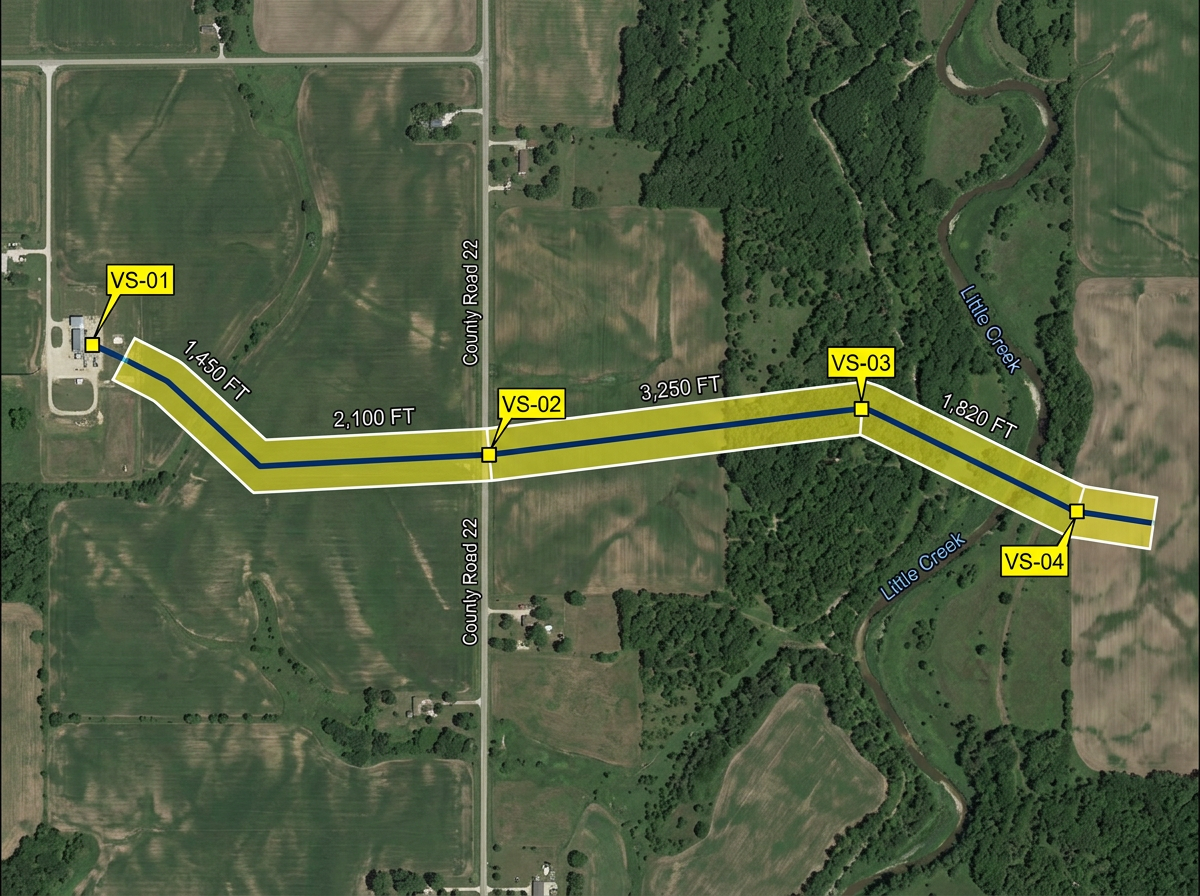
Sketch pipeline routes, valve sites and ROW corridors for engineering, safety and landowner meetings.
Scribble AI
Tell Scribble AI what you need. Try “draw a 500m buffer around every site,” “import this CSV and color by status,” or “measure the route from the depot to each stop.” It does it in seconds. No GIS training needed, and your team gets the same map, ready to share.
Try Scribble AI →★ ★ ★ ★ ★“What I appreciate most about Scribble Maps is its intuitive interface and versatility. It enables me to easily draw, label, and personalize maps without needing advanced GIS expertise.”
★ ★ ★ ★ ★“Gives us the ability to mark areas on maps that may be hard to find for our subcontractors. Some of our work areas are not necessarily a designated address, rather it is an area.”
Yes. Import KML, Shapefile, GeoJSON or CSV. Lease blocks, parcels and existing infrastructure drop directly onto the map.
Yes. Click Share, copy the link and email or text it. Landowners open it in any browser. No install, no account.
Yes. Scribble Maps supports private maps, password protection and AES-256 encryption.
Yes. Export any map to PDF, PNG, KML or GeoJSON for inclusion in regulatory or permitting packets.