

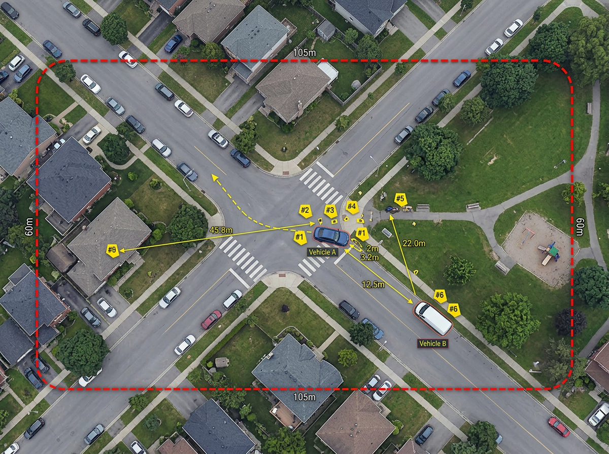
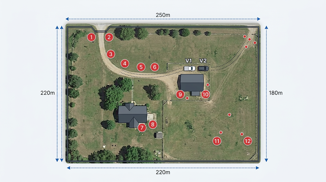
Scene diagrams and evidence
Mark shell casings, blood evidence, vehicles and points of impact on a satellite view. Measure distances and angles right on the map.
Build scene diagrams, search grids and court exhibits in minutes. Share a link with detectives, prosecutors and partner agencies. No CAD license and no GIS team needed.
 4.7 / 5 · 200 reviews on G2
★ ★ ★ ★ ★“As a trial lawyer, I often need to show the jury a map of the scene or a route. Scribble Maps is far superior to other tools, like Google Maps, for making maps for presentations.”
Mark evidence, vehicles and entry points on a satellite view. Measure distances right on the map. No CAD license and no special training.
Share the map with prosecutors, defense counsel and partner agencies. They open it in a browser. No install and no account. Turn off the link any time.
Import KML, Shapefile, GeoJSON or CSV. Add canvass data, call records or old aerial photos on top of the scene.
Mark shell casings, blood evidence, vehicles and points of impact on a satellite view. Measure distances and angles right on the map.
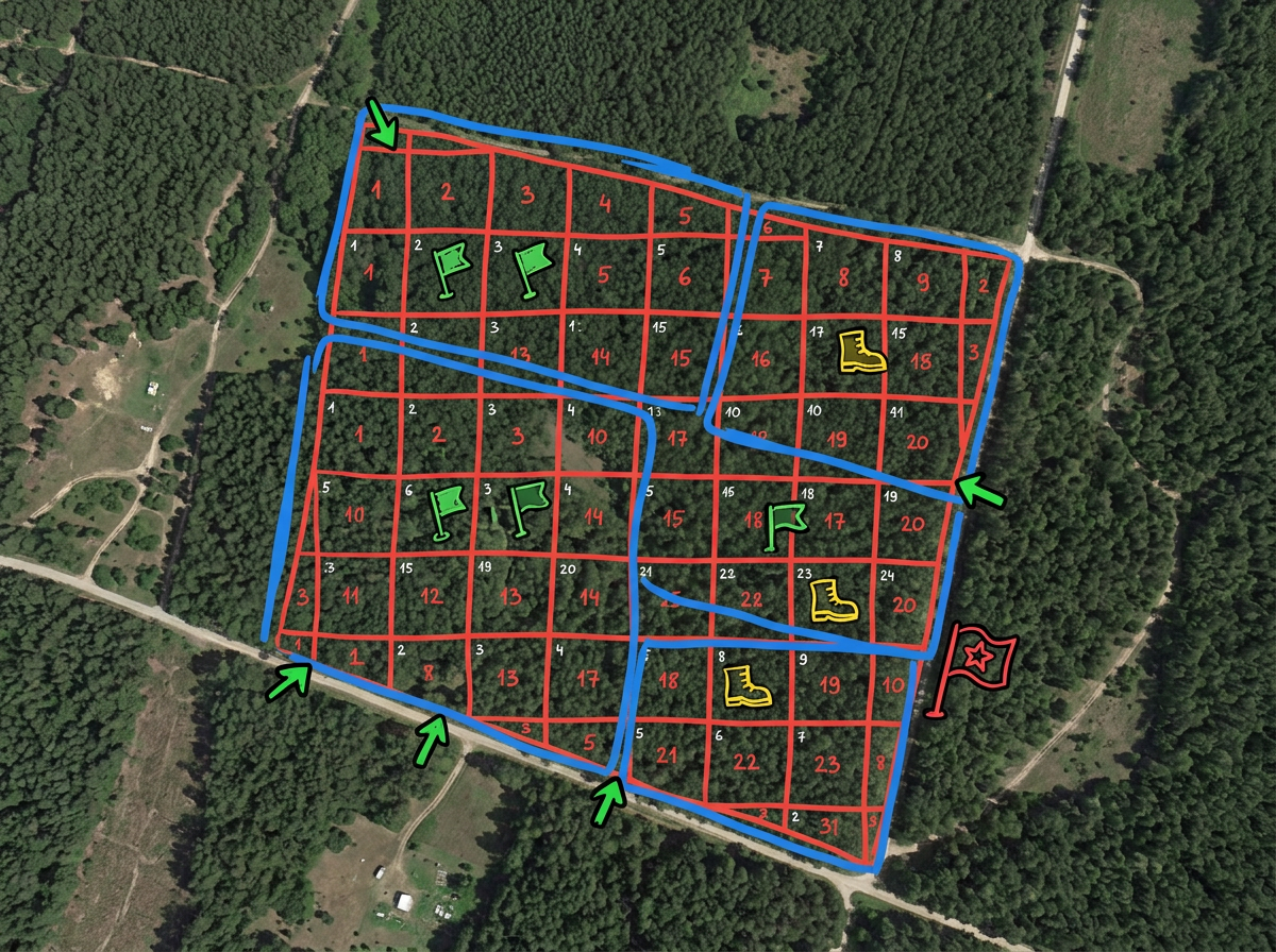
Draw grid sectors for an area search. Give each team a sector. Share a view-only map so every searcher knows the boundary and reports back the same way.
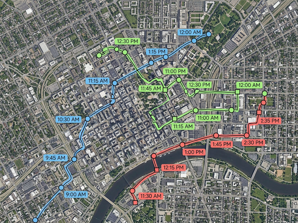
Plot suspect, victim and witness movements with time-stamped markers. Trace routes between scenes. Add call records or ALPR hits on one map.
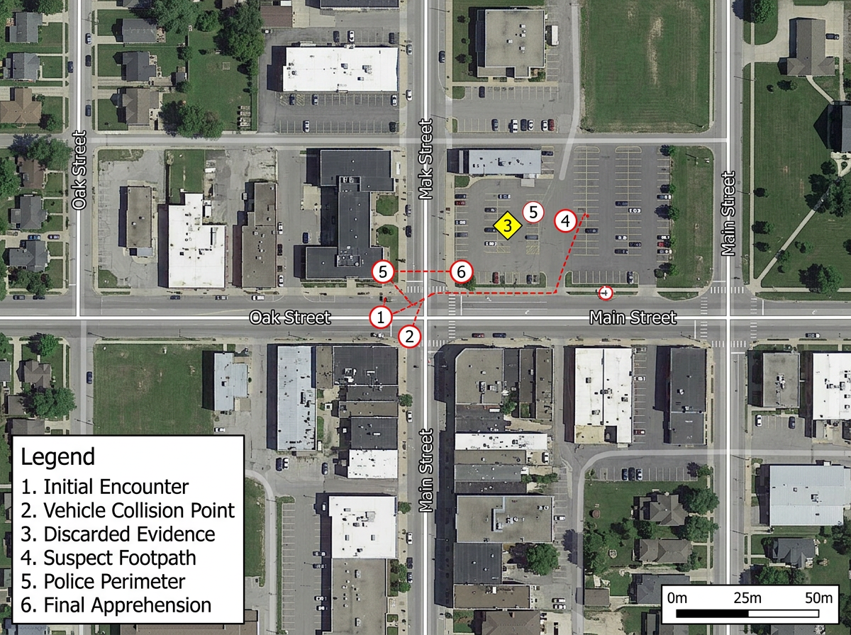
Export a clean, labeled map as PDF or PNG for trial. Show the jury the scene, the route or the search area at a glance, with measurements they can trust.
Scribble AI
Tell Scribble AI what you need. Try “draw a 500m buffer around every site,” “import this CSV and color by status,” or “measure the route from the depot to each stop.” It does it in seconds. No GIS training needed, and your team gets the same map, ready to share.
Try Scribble AI →★ ★ ★ ★ ★“As a trial lawyer, I often need to show the jury a map of the scene or a route. Scribble Maps is far superior to other tools, like Google Maps, for making maps for presentations.”
★ ★ ★ ★ ★“The support we've received from Scribble Maps has been amazing.”
Yes. Scribble Maps supports private maps, password protection and AES-256 encryption. You can turn off a share link any time.
Yes. You can measure distance, area and angles right on the satellite view. Export a labeled map for the case file.
No. Anyone with the share link can open the map in a browser. No install and no account needed.
Yes. Import KML, Shapefile, GeoJSON, GPX or CSV. Add the data on top of any base map and share again.
Yes. Scribble Maps supports SAML, OIDC and SCIM, plus activity and audit logs and user management.