

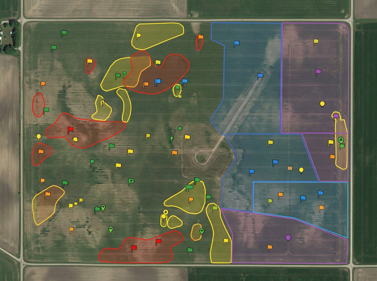
Field and paddock layouts
Draw every field or paddock by name, color by crop or rotation and share with operators, agronomists and family.
Sketch field layouts, plan paddock rotations, draw irrigation runs and brief crews, built for family farms, ranchers, agronomists and crop consultants.
 4.7 / 5 · 200 reviews on G2
★ ★ ★ ★ ★“The thing I like most about Scribble is how easy it is to use. I also love how I can create any maps from scratch. A lot of the maps that I have created are not geo referenced. This has been very helpful to me when I have been creating these farm maps.”
Sketch field boundaries, paddocks and irrigation runs on real satellite imagery. No GPS unit, no GIS training.
Send the day's work map to the operator, agronomist or hauler. They open it on a phone. No app, no install.
Import KML, Shapefile, GeoJSON, GPX and CSV from monitors, drones and farm software. Layer it all on one map.
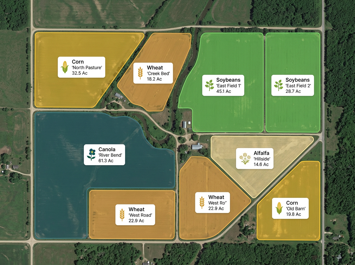
Draw every field or paddock by name, color by crop or rotation and share with operators, agronomists and family.
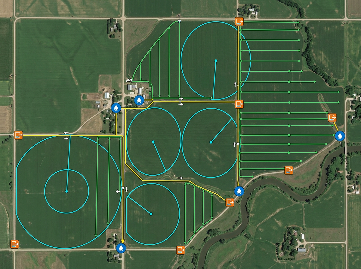
Sketch irrigation runs, pivot circles, drain tile and water sources for the crew and the irrigation contractor.
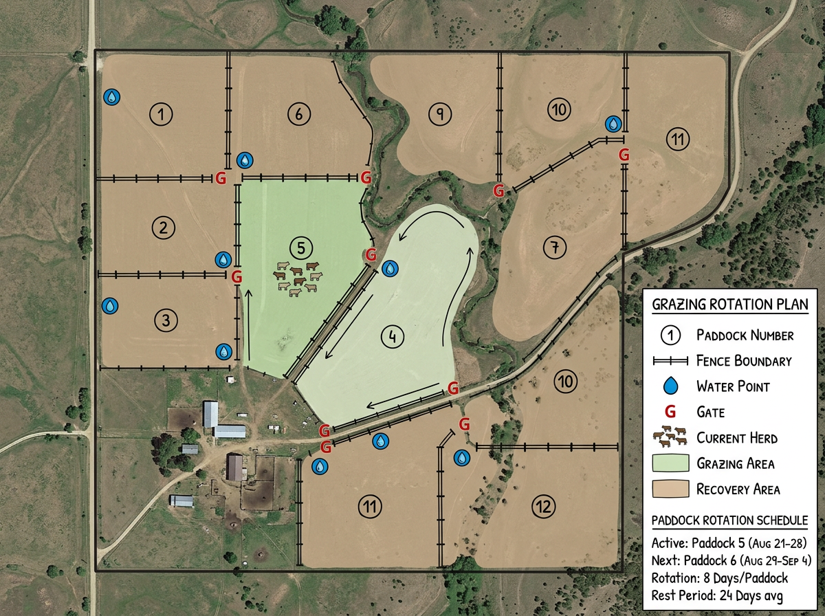
Lay out grazing paddocks, fences, water points and gates. Plan rotations and share the schedule with ranch hands.
Build field exhibits for grower meetings, scout reports and program planning. Share by link or print to PDF.
Scribble AI
Tell Scribble AI what you need. Try “draw a 500m buffer around every site,” “import this CSV and color by status,” or “measure the route from the depot to each stop.” It does it in seconds. No GIS training needed, and your team gets the same map, ready to share.
Try Scribble AI →★ ★ ★ ★“The thing I like most about Scribble is how easy it is to use. I also love how I can create any maps from scratch.”
★ ★ ★ ★ ★“Easy to use to plan field layouts for planting new orchards on slopes.”
Yes. Import KML, Shapefile, GeoJSON, GPX or CSV. Existing field boundaries and yield data drop directly onto the map.
Yes. Click Share, copy the link and text it to them. They open it on a phone. No app, no install.
Yes. Sketch field boundaries directly on satellite imagery. No GPS, no field walk required.
Yes. Scribble Maps is free to start, with paid options for larger imports and advanced tools. See the pricing page for details.